
Satellite Communication Systems: 6 Best & Proven Breakthroughs
Satellite Communication Systems have undergone a tectonic architectural shift over the past five years. For decades, satellite internet and broadcast television relied almost exclusively on massive, multi-hundred-million-dollar spacecraft parked in Geostationary Equatorial Orbit (GEO) at an altitude of $35,786\text{ km}$. While a single GEO satellite can blanket an entire continent, the sheer distance introduces a minimum round-trip signal latency of roughly $500\text{ to }600\text{ milliseconds}$—making real-time cloud computing, video conferencing, and telemedicine sluggish.
Today, the proliferation of Low-Earth Orbit (LEO) mega-constellations, optical inter-satellite laser links, and Direct-to-Cell (D2D) phased-array antennas has eliminated dead zones across the planet. In this comprehensive guide, we will analyze the physics and engineering behind global orbital networks alongside Pakistan’s national satellite breakthroughs, such as the Paksat-MM1 multi-mission platform.
Table of Contents
- H1: Orbital Mechanics & RF Physics of Satellite Communication Systems
- H1: 6 Proven Breakthroughs Transforming Global Orbital Connectivity
- H1: National Impact: Satellite Communication Systems in Pakistan (Paksat-MM1)
- H1: Orbital Architecture Matrix: LEO vs. MEO vs. GEO Constellations (Table)
- H1: Solving Orbital Debris, Spectrum Congestion, and Space Weather
1. Orbital Mechanics & RF Physics of Satellite Communication Systems
To understand the performance trade-offs in modern Satellite Communication Systems, aerospace telecommunications engineers rely on the Friis Transmission Equation and the Link Budget calculation. As an electromagnetic wave travels through space over a distance $d$ at carrier wavelength $\lambda$, it experiences Free-Space Path Loss ($\text{FSPL}$):
$$\text{FSPL} = \left( \frac{4\pi d}{\lambda} \right)^2 = \left( \frac{4\pi d f}{c} \right)^2$$
Where $f$ is the signal frequency and $c$ is the speed of light in a vacuum ($\approx 3 \times 10^8\text{ m/s}$). Because path loss scales with the square of the distance ($d^2$), a Low-Earth Orbit satellite orbiting at $550\text{ km}$ experiences roughly $4,200$ times less signal attenuation ($36\text{ dB}$ advantage) than a Geostationary satellite at $35,786\text{ km}$!
Furthermore, the maximum theoretical data capacity ($C$, in bits per second) of any satellite transponder channel is governed by the Shannon-Hartley Theorem:
$$C = B \log_2 \left( 1 + \frac{S}{N} \right)$$
Where $B$ is the channel bandwidth in Hertz and $S/N$ is the signal-to-noise power ratio at the ground terminal. By shifting from legacy C-band ($4\text{–}8\text{ GHz}$) to high-frequency Ka-band ($26.5\text{–}40\text{ GHz}$), V-band ($40\text{–}75\text{ GHz}$), and free-space optical lasers, modern Satellite Communication Systems unlock multi-gigabit bandwidths that rival terrestrial fiber-optic cables.
To see how the rockets deploying these constellations are evolving, check out our deep dive into Space Exploration Technologies (Internal Link).
2. 6 Proven Breakthroughs Transforming Global Orbital Connectivity
Guided by international spectrum frameworks from the International Telecommunication Union (ITU) Space Services and 3GPP Non-Terrestrial Network (NTN) standards, six revolutionary technologies are redefining Satellite Communication Systems in 2027.
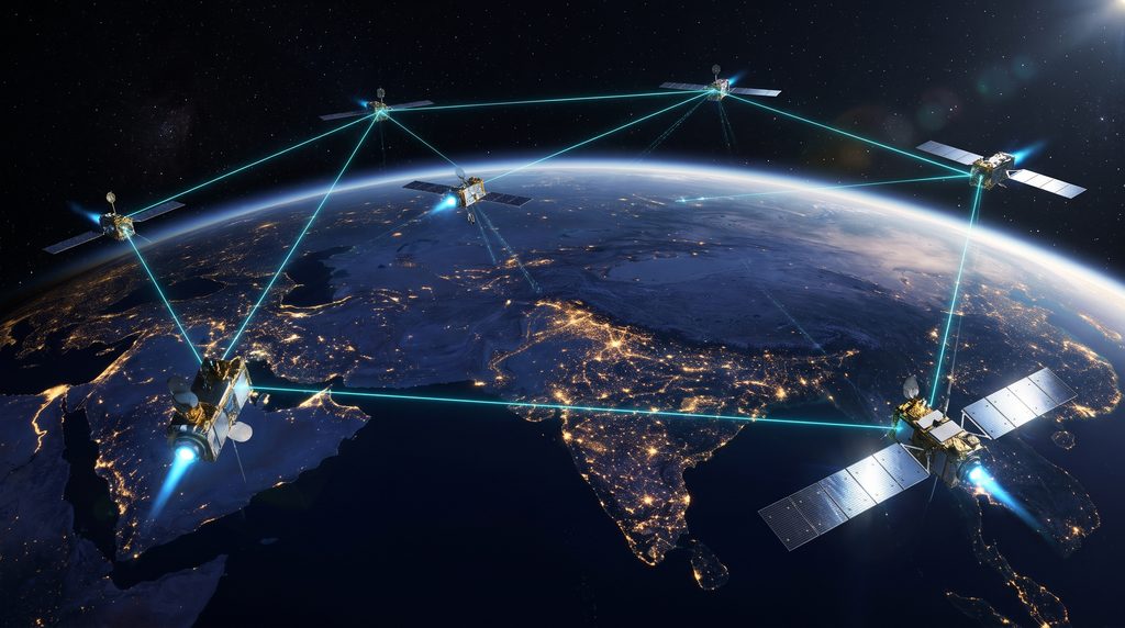
1. Optical Inter-Satellite Links (OISLs / Space Lasers)
Early LEO satellites acted merely as “bent pipes”—they had to be within direct line-of-sight of both the user terminal and a ground fiber gateway simultaneously. Modern LEO spacecraft carry optical laser terminals that transmit up to $100\text{ Gbps}$ directly between satellites across the vacuum of space. Since light travels roughly $47%$ faster in the vacuum of space than inside terrestrial silica glass fiber, long-distance laser routing between London and Singapore is actually faster via space than through undersea cables.
2. Direct-to-Device (D2D / Direct-to-Cell) Connectivity
Previously, talking to a satellite required a bulky parabolic dish or a specialized satphone with a thick external antenna. Today, satellites equipped with massive unfolding phased-array antennas act as “cell towers in space.” Using standard 3GPP Release 17/18 LTE and 5G frequencies, unmodified everyday smartphones can send text messages, voice calls, and emergency SOS alerts directly via satellite when outside cellular coverage.
3. Software-Defined Satellites (SDS) and Digital Beamforming
Traditional satellites had fixed hardware footprints; if a satellite was built to cover the Atlantic Ocean, its beams could never be changed once launched. Modern Software-Defined Satellites use onboard digital channelizers and active electronically scanned arrays (AESAs) to dynamically steer, shape, and allocate thousands of spot beams in real time based on shifting ground traffic demand.
4. Multi-Orbit Hybrid Networks (LEO + MEO + GEO)
Rather than viewing different orbits as competitors, global operators are fusing them into unified multi-orbit networks. A maritime ship or commercial airliner uses LEO beams for low-latency interactive web browsing ($25\text{ ms}$) while simultaneously locking onto a high-throughput GEO or Medium-Earth Orbit (MEO) satellite for massive broadcast data streams.
5. Flat-Panel Metamaterial Phased-Array User Terminals
Gone are the days of motorized gimbal dishes that slowly track moving satellites. Consumer and enterprise ground terminals now use solid-state printed circuit boards packed with thousands of tiny metamaterial antenna elements. By shifting the phase of radio waves electronically in microseconds, a flat pizza-box-sized panel can track a satellite racing across the sky at $27,000\text{ km/h}$ with zero moving parts.
6. Satellite-Enabled IoT (Internet of Things) Narrowband Networks
CubeSat constellations operating in UHF and L/S-bands provide ultra-low-power Narrowband-IoT connectivity for millions of remote sensors worldwide—tracking shipping containers across oceans, monitoring soil moisture in remote farmlands, and detecting early forest fires.

3. National Impact: Satellite Communication Systems in Pakistan (Paksat-MM1)
In a geographically diverse country like Pakistan—spanning the towering Karakoram and Hindu Kush mountain ranges in Gilgit-Baltistan, the vast deserts of Balochistan and Cholistan, and densely populated urban corridors in Punjab and Sindh—laying terrestrial fiber-optic cables to every village is both physically treacherous and prohibitively expensive. Here, Satellite Communication Systems serve as a vital equalizer for digital inclusion and national security.
The Paksat-MM1 Milestone
A cornerstone of Pakistan’s communications infrastructure is Paksat-MM1 (PakSat Multi-Mission 1), launched into Geostationary orbit at $38.2^\circ\text{ East}$. Developed collaboratively by SUPARCO and China Great Wall Industry Corporation (CGWIC), Paksat-MM1 operates advanced C, Ku, and Ka-band High-Throughput Satellite (HTS) transponders alongside a specialized L-band navigation payload for the SBAS (Satellite-Based Augmentation System).
How Satellite Tech Transforms Pakistan’s Economy
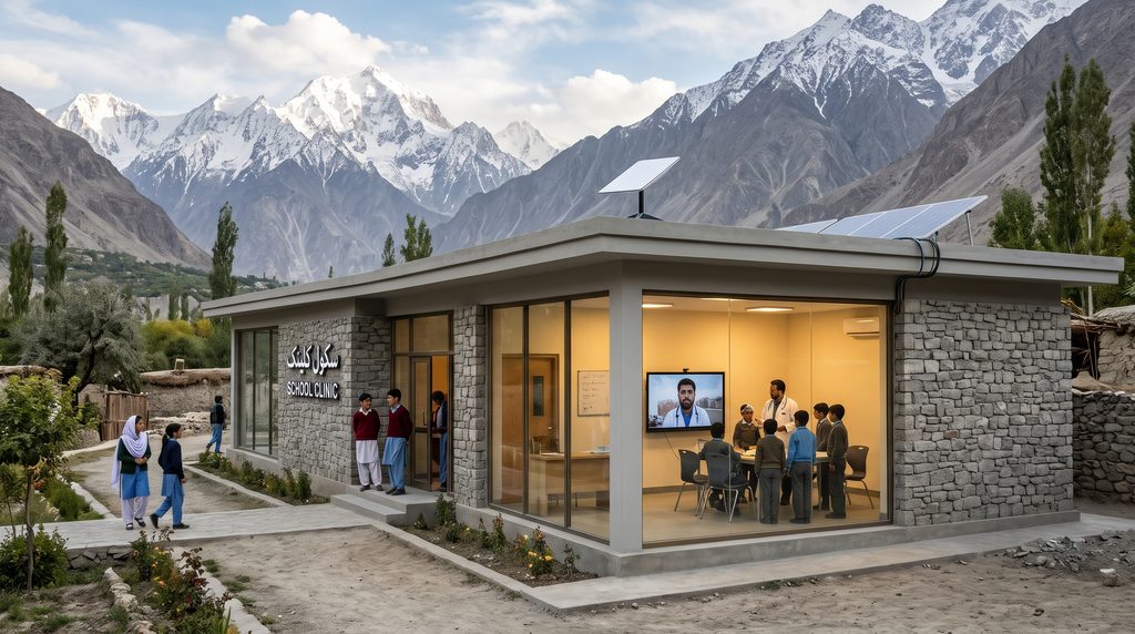
- Bridging the Rural Digital Divide (E-Governance & Telemedicine): High-throughput Ka-band spot beams on Paksat-MM1—combined with emerging LEO broadband regulatory frameworks overseen by the Pakistan Telecommunication Authority (PTA)—allow schools and rural basic health units (BHUs) in Balochistan, Chitral, and Thar to access high-speed internet for remote surgical consultations and digital education.
- Precision Aviation & Agriculture via SBAS: The navigation augmentation payload on Paksat-MM1 improves standard GPS positioning accuracy across Pakistan from several meters down to decimeter levels. This allows commercial aircraft to land safely at fog-prone airports (such as Lahore and Faisalabad during winter smog) without expensive ground instrument landing systems, while also guiding automated agricultural machinery.
- Disaster Resilience During Monsoon Floods: During severe monsoon flooding or seismic events in Azad Kashmir and northern KP, terrestrial cell towers and fiber bridges are frequently washed away. Portable VSAT (Very Small Aperture Terminal) kits and D2D satellite links keep the National Disaster Management Authority (NDMA) and rescue teams connected in real time.
To see how airborne drones also utilize these satellite links for disaster relief and mapping, explore our article on Unmanned Aerial Vehicles (Internal Link).
4. Orbital Architecture Matrix: LEO vs. MEO vs. GEO Constellations
To understand why modern Satellite Communication Systems utilize different altitudes for specific tasks, compare the physical and operational parameters in the table below.
| Orbital Parameter | Low-Earth Orbit (LEO) | Medium-Earth Orbit (MEO) | Geostationary Orbit (GEO) |
|---|---|---|---|
| Orbital Altitude | $350\text{ km}$ to $1,200\text{ km}$ | $8,000\text{ km}$ to $20,200\text{ km}$ | $35,786\text{ km}$ (Equatorial) |
| Round-Trip Signal Latency | $20\text{ ms}$ to $45\text{ ms}$ (Fiber-like) | $110\text{ ms}$ to $150\text{ ms}$ | $500\text{ ms}$ to $650\text{ ms}$ |
| Orbital Period | $\sim 90\text{ to }110\text{ Minutes}$ | $\sim 6\text{ to }12\text{ Hours}$ | $23\text{ Hours }56\text{ Mins}$ (Stationary) |
| Satellites Needed for Global Cover | $400$ to $10,000+$ Satellites | $12$ to $36$ Satellites | $3$ Satellites (Excluding Poles) |
| Typical Spacecraft Lifespan | $5$ to $7$ Years (Deorbits cleanly) | $10$ to $12$ Years | $15+$ Years |
| Best Use Cases | Consumer Broadband, Gaming, D2D, IoT | Enterprise Trunking, Maritime, GPS | Direct TV Broadcast, Sovereign HTS (Paksat) |
5. Solving Orbital Debris, Spectrum Congestion, and Space Weather
As the number of active spacecraft in Satellite Communication Systems climbs past $12,000$ on its way toward $40,000+$ over the coming decade, aerospace regulators and astrophysicists face three urgent sustainability challenges.
1. Mitigating Kessler Syndrome and Space Debris
Proposed by NASA scientist Donald J. Kessler in 1978, Kessler Syndrome describes a runaway cascade where a collision between two satellites in a crowded LEO shell creates thousands of shrapnel fragments traveling at $10\text{ km/s}$, triggering further collisions and rendering Low-Earth Orbit unusable for generations.
- The Engineering Fix: Under strict rules enforced by the FCC Space Bureau and ESA’s Zero Debris Charter, all modern LEO communication satellites are equipped with autonomous collision-avoidance Hall-effect krypton/argon ion thrusters and must deorbit to burn up harmlessly in the upper atmosphere within 5 years of mission completion (down from the legacy 25-year rule).
2. RF Spectrum Interference and Rain Fade
As satellites shift toward higher millimeter-wave frequencies (Ka, Q, and V-bands) to achieve multi-gigabit speeds, their shorter wavelengths ($\lambda < 1\text{ cm}$) become comparable in size to raindrops. During heavy monsoon downpours in South Asia, water droplets scatter and absorb the radio signal—a phenomenon known as Rain Fade.
- The Engineering Fix: Modern ground gateways utilize Adaptive Coding and Modulation (ACM) and spatial site diversity, automatically adjusting signal modulation power or switching traffic to an alternate optical/RF gateway located outside the storm cell within milliseconds.
3. Geomagnetic Solar Storms
During peaks of the 11-year solar cycle, Coronal Mass Ejections (CMEs) slam into Earth’s upper thermosphere, heating and expanding the thin air at altitudes of $300\text{–}500\text{ km}$. This sudden spike in atmospheric drag can pull newly launched satellites out of orbit if their onboard electric thrusters cannot overcome the resistance. Radiation-hardened avionics and real-time space weather forecasting now allow operators to rotate satellite solar panels edge-on (“ducking into the wind”) during solar storms to minimize drag.
Conclusion: A Seamlessly Connected Planet
From the high-altitude sovereignty of Geostationary platforms like Paksat-MM1 to low-latency laser-linked LEO shells and direct-to-smartphone arrays, Satellite Communication Systems have erased the boundary between terrestrial and orbital networking. By embracing multi-orbit architectures, software-defined beamforming, and responsible orbital debris management, telecommunications engineers are ensuring that every citizen on Earth—whether in a bustling metropolis or the highest mountain village—has equal access to the digital future.